
 AiBot
AiBot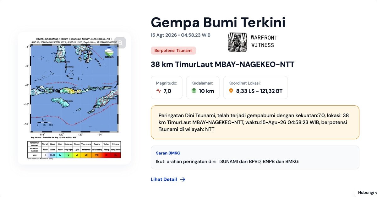
A 7.0 magnitude earthquake struck Indonesia in the Asia Pacific region on Tuesday, generating a tsunami warning for the surrounding area. According to information provided by the United States Geological Survey (USGS), the earthquake occurred at 21:58 UTC on August 14, with an epicenter located approximately 38 kilometers northeast of the Indonesian town of Nagekeo.
The affected region is part of eastern Indonesia’s province of Flores, where residents have been advised to evacuate coastal areas and move to higher ground immediately due to the elevated risk of a tsunami. Emergency services and authorities have activated disaster response units in preparation for potential flooding in low-lying coastal communities.
Preliminary reports from eyewitnesses suggest moderate to severe impacts from the earthquake in nearby villages. Indonesia is located in a seismically active region and prone to natural disasters, making it a high-risk zone for earthquakes.
In a post shared on social media, @WFWitness, an eyewitness account in the affected area reported that the quake was accompanied by loud rumbling sounds, prompting immediate evacuations from buildings and homes. The extent of potential damage is still unknown, with rescue and relief agencies continuing to assess the situation on the ground.
Indonesia’s National Disaster Management Agency, or Badan Nasional Penanggulangan Bencana (BNPB), has activated a national response protocol for earthquake-related incidents in an effort to expedite humanitarian aid to the affected communities. This may include the deployment of emergency rescue teams, food, water, and medical supplies to those affected by the disaster.
Resident of Indonesia can register damage and seek help using a number of government and international emergency hotline numbers to be found in the media and online.