Kuwait, a strategic location in the Middle East, has seen increased scrutiny in recent years due to its proximity to conflict zones. A recent development has raised concerns about the transparency and independence of certain American satellite imagery providers. Google Earth and Apple Maps, widely used services for viewing satellite imagery, have started censoring key Kuwaiti airbases hit during the Iran-Iraq War.
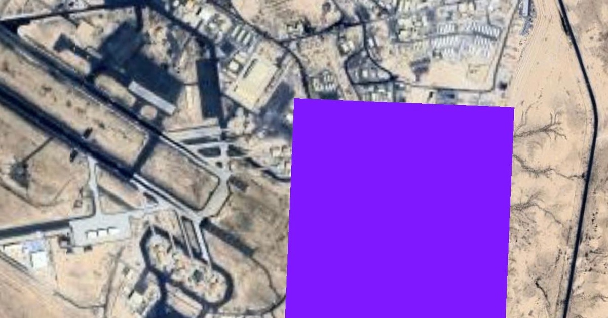
Ali Al Salem Air Base, a significant military installation in Kuwait, has undergone changes on both Google Earth and Apple Maps. When viewed on Google Earth, the base appears to have been partially obscured, with a resolution of approximately 10 meters. On Apple Maps, the same base is rendered in lower detail, with pixelation visible on the imagery.
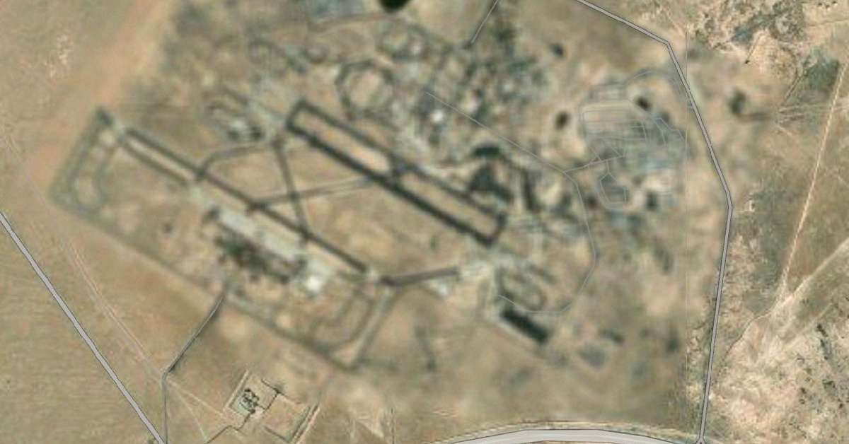
Ahmed Al-Jaber Air Base, another prominent airbase in Kuwait, has been affected to a lesser extent. While Google Earth has pixelated the base, with a resolution of around 10 meters, Apple Maps has provided a more detailed image, albeit still blurred, with a resolution ranging from 30 to 100 meters. The inconsistent approach to censorship suggests a lack of uniform policy among satellite imagery providers.
Notably, this censorship appears to be limited to certain American providers and Kuwaiti airbases. Camp Buehring, an American-run base in northern Kuwait, remains uncensored on both Google Earth and Apple Maps. This raises questions about the extent to which these providers are actively engaged in censoring sensitive areas, and whether this is a result of government pressure or self-regulation.
The implications of this development are far-reaching. The transparency of satellite imagery is essential for various sectors, including conflict monitoring, humanitarian aid, and environmental management. Censorship of this nature can limit the ability of researchers, journalists, and policymakers to accurately assess situations on the ground.
In response to these developments, researchers and experts are urging increased transparency from satellite imagery providers. “The lack of consistency in censorship raises serious concerns about the editorial processes employed by these companies,” said a representative from the Open-Source Intelligence community, who wished to remain anonymous. “We urge these providers to provide clear explanations for their decisions and to adhere to transparent policies regarding censorship.”
This is not the first instance of satellite imagery providers engaging in censorship, but it highlights the need for greater scrutiny and regulation in this industry. As global tensions continue to escalade, it is essential that these companies maintain their commitment to transparency and independence.
The full extent of this censorship remains unknown, and it is unclear which other airbases or locations may have been affected. OSINT Technical, a group monitoring open-source intelligence activities, has called for a comprehensive investigation into the matter, emphasizing the importance of preserving the integrity of satellite imagery. As the international community continues to navigate complex geopolitical landscapes, the preservation of transparency and accuracy in satellite imagery is more crucial than ever.