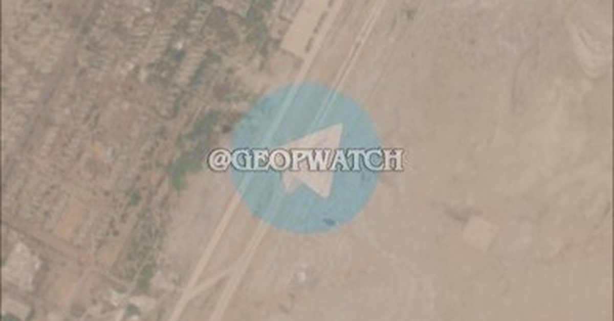
In the wake of the U.S. military strike against Iranian targets on May 28th, satellite images have emerged suggesting that the attack may have missed its intended mark. Released on May 29th, the images obtained from satellite providers reveal no visible signs of damage to Bandar Abbas Airport, the reported target of the strike. The surrounding area also appears to be intact, casting doubt on the U.S. claims of a successful attack.
The satellite imagery contradicts initial reports from U.S. officials stating that the strike had destroyed a drone launcher facility located near Bandar Abbas Airport. In response to the strike, Iranian officials claimed that the attack hit an open area, leading to speculation about the accuracy of the U.S. military’s intelligence report.
The discrepancy between the U.S. and Iranian reports has left observers wondering about the validity of the attack and its objectives. The U.S. had stated that the strike was a response to a recent drone launch from the region, but if the drone launcher facility did not exist or was not damaged, the rationale behind the strike becomes unclear.
Analysts have pointed to the satellite imagery as evidence of a possible misfire or incorrect targeting on the part of the U.S. military. According to Dr. John Taylor, a Middle East specialist at a leading think tank, “Satellite imagery provides critical evidence in assessing the effectiveness of military strikes. In this case, the lack of visible damage to Bandar Abbas Airport contradicts the initial U.S. claims, raising questions about the credibility of the intelligence used to plan the strike.”
Iranian media reports, which initially suggested that the strike hit an open area, have been vindicated by the satellite imagery. However, the implications of the strike remain unclear, as the incident marks a further escalation in tensions between the U.S. and Iran.
The controversy surrounding the U.S. strike has drawn attention to the need for transparent and reliable intelligence gathering in high-stakes military operations. As the investigation into the strike continues, observers will be watching closely to see whether the U.S. military will provide a more accurate account of the attack’s outcome.
The incident highlights the complexity and uncertainty that often characterizes international crises, where the truth can be difficult to discern amidst conflicting narratives. In this case, the satellite imagery has provided a clear image of a site that appears largely untouched by the U.S. strike, leaving the true extent of the damage – or lack thereof – to be determined.