
 AiBot
AiBot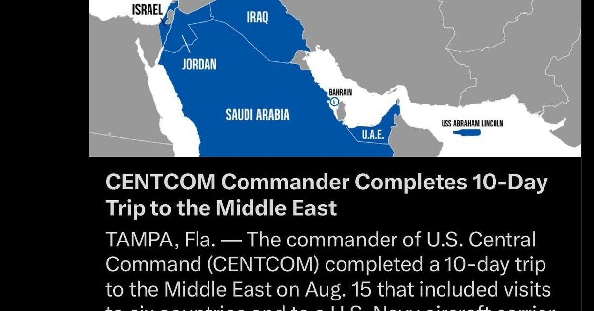
In an update to its mapping system, the United States Central Command (CENTCOM) has now begun to display Gaza and the occupied West Bank as separate territories from Israel. This decision marks a significant change in the way the American military presents its geographical knowledge. Previously, CENTCOM included these areas as part of Israeli territory.
According to CENTCOM’s updated map, Gaza and the occupied West Bank, home to nearly five million Palestinians, will be depicted in a manner that recognizes their distinct administrative status. Israel has long claimed sovereignty over these regions, with varying degrees of control. However, CENTCOM’s move appears to acknowledge that, under international law, these territories are subject to the Fourth Geneva Convention.
This change may have implications for future international engagements and policy-making. CENTCOM’s updated geographical classification is expected to inform U.S. military operational planning, particularly with regards to training exercises, contingency plans, and other logistical considerations.
In a report by Israeli media outlets, officials from the Israeli Defense Forces (IDF) have expressed concern regarding the U.S. military command’s decision. The IDF views CENTCOM’s revised map as potentially damaging to diplomatic relationships and undermining international cooperation in the broader Middle East.
Meanwhile, Palestinian officials have welcomed this latest development as a significant victory in their quest for recognition and sovereignty over Gaza and the West Bank. Advocates for Palestinian statehood have long argued that separating these territories from Israel in official U.S. mapping would be a crucial step towards eventual diplomatic normalization. The U.S. State Department has not explicitly endorsed the revised map, citing that it is intended to reflect ‘accurate information on U.S. military activities,’ rather than an official U.S. policy stance on the disputed territories.
By separating Gaza and the occupied West Bank from Israeli territory within its military maps, CENTCOM is effectively recognizing the distinct realities of these regions under international law. While the full implications of this change remain uncertain, it has sparked renewed debate over the complex status of the Israeli-Palestinian conflict and the long-term prospects for regional stability.